Sunday 14 February 2016

Looping Singapore by Bicycle


Prologue

The plan was to cycle around the island of Singapore, staying as close to the coast as possible. Fortunately the rains stopped by 4pm on Sunday, 7th of Feb 2016, the eve of the Lunar New Year, and I started at 4.30pm from my usual place at the East Coast Park near the Siglap connector.

I headed west, hoping to cover new regions in that direction before the rains returned. The other advantage of heading west first was that I got to see the eastern regions the next day in the early morning light, something I had not experienced before.

Picking the new year eve, and continuing overnight to the following day turned out to be a good choice as the roads were essentially deserted, providing a peaceful cycling experience. I stayed on the park connectors and side-walks where possible, but ventured onto the quiet roads when necessary.


Westward

The stretch from the East Coast Park to the Marina Barrage, and then continuing behind that to Keppel Road and the West Coast Highway until Alexandra Road was familiar territory from my previous rides. Took a snack break at about 7pm at a fast food place, one of the few places open, in mall near Labrador MRT.

It was peaceful as I continued along the West Coast Highway. Noticed the renovated exterior of the Haw Paw Villa. Further down, beyond Clementi I was surprised to discover that there were many private housing developments on the right of the highway, facing the industrial buildings on the other side.

I missed the turn into Jalan Buroh and the planned route along the south of the Pandan reservoir, so I cycled on along Jurong Town Hall Road. At this point I had a craving for a hot drink, and detoured to Jurong East MRT which had a big crowd gathered about the malls. Again only a few fast food places were open, but it was enough for me to get re-energised on a hot milo there. Discovered the location of the new Ng Teng Fong hospital across the road.

From there I continued along Boon Lay Way, a new region to me, until Jalan Bahar, a name that was vaguely familiar from my NS days.


Northward

Went up Jalan Bahar and took a rest and refreshment break at a void deck of HDB flats. I had to decide whether to press forward through what the map indicated to be a long stretch of forested area, or to take a nap. I tried napping but couldn’t doze off, but the rest was sufficient and I felt I could continue. I felt re-assured that there were bus-stops along the stretch that could provide shelter in case it started raining.


Passed the entrance to NTU and then the huge Civil Defence Academy. There was nothing else to see along that stretch of Jalan Bahar, and it felt somewhat spooky. Beyond that it was the wide and straight Lim Chu Kang road, which felt peaceful despite the signs and paths pointing to the cemeteries on the left.
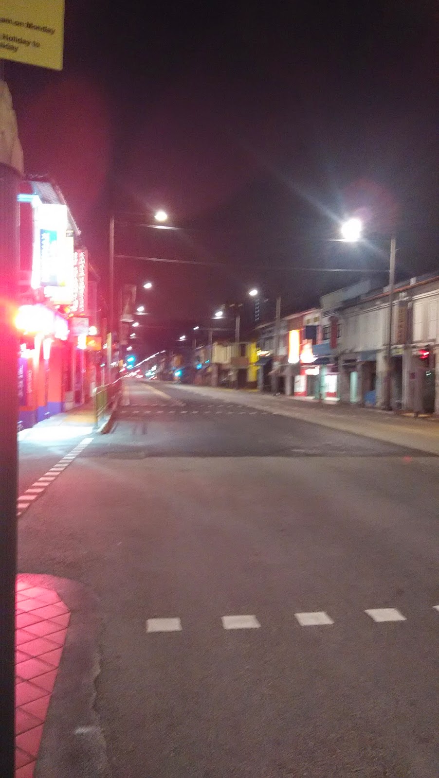
LCK Road


By now my legs were beginning to ache, maybe because I hadn’t cycled for a long time before the day's event, and maybe because I had just recovered from a bout of stomach flu. I needed to rest my legs, which I did at a bus stop along LCK road. It was midnight.


LCK road never seemed to end, but eventually it did become narrower and winding, with more greenery. I took more breaks as I went along, one outside the Sungei Gedong camp, another name familiar from my NS days.


Narrower Part of LCK Road


It wasn’t completely deserted, as at least one vehicle passed me every minute or so. But I saw only one or two other cyclists that night, the rest appearing only later around sunrise.

I heard what sounded like life-firing outside the life-firing area, but was surprised that such an event would be going on on that day. It sounded more like fire-works, but why would there be fire-works in this secluded place? The mystery would be solved a few kilometres down the road.


Eastward

Turned into Neo Tiew Road, passing many farms, and the entrance to Sungei Buloh, before emerging onto Kranji Way on the dam forming the Kranji reservoir. 


From here I could look across to Johor Bahru (Malaysia), and see and hear them celebrating the Lunar New Year with fire-works.

View of JB from Kranji Way


My leg muscles were tight and aching, the rest stops and self-massages not helping much. That is when I discovered a solution. I found that walking actually released the tension in the muscles. Maybe the walking and cycling muscles were complementary.

So my new strategy was to walk my bike up steep inclines, cycle along flat stretches on low gear (to save my knees), and let gravity do all the work on down slopes.

I needed a good meal, and a web-search indicated a 24 hr fast food place at admiralty MRT. It took immense effort to continue till there, through Kranji Road, into Woodlands Road, Woodlands Ave3, and Woodlands Ave 7.

Reached the place at about 3.30am and was disappointed that they had no whole day breakfast and no toilet. Got a meal anyway, replacing the sugary drink with a hot milo. The meal and rest did me good. In fact I dozed off there, maybe encouraged by another “auntie” who was taking a cosy nap nearby. The other patrons were all youngsters.


To Quit or to Continue?

I then had to decide whether to continue with my plan, there was still a long way to go, or cut the trip short. I felt that I would probably not try anything as crazy as this again, so I had better finish the job, albeit slow and easy. (The last time I did such an endurance event was decades ago during my NS days, but back then I didn’t have a choice).

From Admiralty, I followed the MRT line to Yishun. By then, 5.30am, the buses and MRT were starting operation and some people were going to work! Took a toilet break at the mall at Yishun.

Then I cut through Yishun Central towards Ave 1 and the dam across the Lower Seletar Reservoir, essentially reversing the path I had taken on another cycling trip. I turned north into Seletar East Link which seemed depressingly unending. It was along this stretch that I saw many early morning cyclists. One of them gave me a wave of encouragement when he saw me walking my bike during one of my walk-ride stretches.
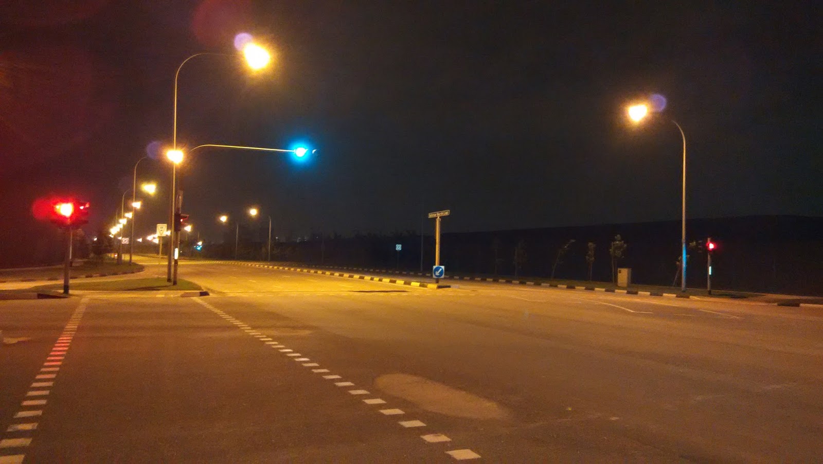

Seletar East Link


Hit Punggol by day-break but couldn’t make out how to get onto Coney Island quickly (to see the cow), so I settled for a ride along the waterway. This was the first time I was in this area at daytime, so I got to view the existing and the many new flats under construction.

Day break at Ponggol Waterway


Crossed over Lorong Halus into Pasir Ris and was in very familiar territory. Found a coffee shop open in Elias Mall along Pasir Ris Drive 3. That was my breakfast stop.


Now I got my second-wind and felt the mission was on back on course.

At the end of Pasir Ris Drive 3 I saw a petrol station and felt maybe it would be good to pump up my back tire a bit more. Unfortunately I ended up deflating it and had problems re-inflating it. Another cyclist, a good Samaritan tried to assist me but we ended up damaging the inner tube.

Without much thinking I continued walking along Loyang Avenue towards Changi Village, hoping to get repairs done there. But the two bicycle shops there were closed as it was the first day of the Lunar New Year ( I didn’t know there was also a bike shop along the park connector that might have been open).

So with much trepidation, I locked my bike in front of the hawker centre and took the bus home on Monday, 8th Feb 2016, at about 11am.

At least I was lucky that my cycling had not been interrupted by rain, though I had come prepared for that possibility.

Home and Return

I rested on the 8th and recovered by the 9th , helped by a good massage and good food. Finally, on the morning of the 10th, I headed for Changi Village. Was very happy to find my bike still there and in one piece. Got it fixed at the bike shop that had opened. Also decided to get some DIY tools to fix similar problems in the future.

Rode home contented along the Changi Coastal Park Connector and got to see Terminal 5 and the new runway under construction.

It started to drizzle lightly but fortunately there was no downpour and I made it home.


Epilogue
An exhausting trip, but worth the try. Good to see many relatively rustic sights still existing in Singapore.

I had to depart at parts from my original plan, so there are things that I probably missed. Well, that’s another opportunity calling !

Till next time !


Monday 6 April 2015

Cross-country Night Cycling 4-5 April 2015


For this trip, I intended to start at my usual spot on the Eastern shore and make it to Seletar airport in the north, then turn  around and come back along Bukit Timah, circling all the major water catchment areas.

ECPark to Seletar

Started at the Siglap connector at East Coast Park at 4.25 pm Saturday.  The route up the connector to Kembangan was the usual (see previous blog post). Took the opportunity to pump my tires for free at the Shell petrol station on Changi Road near the end of the first stretch of the connector.  The connector continues behind Kembangan MRT.  Having used this connector several times, I have learnt  several short cuts to get off it and onto other roads: I like to turn into the housing estate in Jalan Daud, just before the PIE, and go all the way down the road to a seemingly dead end; but look at the right corner and you will find a small exit ramp that's leads you to the pedestrian crossing at Eunos Link.

Up along Eunos link, I turned left into Bartley Road and then right up along Upper Paya Lebar Road. This last road is not my favourite for cycling because of massive traffic and very narrow sidewalks (yeah, yeah, pedestrian sidewalks are not lawfully meant for cyclists, but since road vehicles don't give cyclists much space here, safety reasons in some situations strongly suggest the sidewalks; just look out for the odd walker---outside city/town centres hardly anyone walks around much).

[Note 1: One side of every road typically has much broader sidewalks than the other side, so choose wisely. UPLebar Road is undergoing some widening of its sidewalks. ]
[Note 2: Follow Law. Don't cycle on pedestrian sidewalks. Hmmm...]

From there it was onto Boundary Road and then into Lorong Chuan --- first time there, although I had heard about it. Nice vibes. Next turn was into  Serangoon Gardens. Had not been there in decades. It was nice to see the roundabout, which I remember, still there.

From Serangoon Gardens I headed North, cut through the Ang Mo Kio Industrial estate, and found Seletar Hills. As I mentioned in an earlier post, Ang Mo Kio didn't exist when I was growing up. It was all forested area, as was much of both sides of Yio Chu Kang Road (and most of Nee Soon, Sembawang, Ponggol...)

Got slightly lost in the western end of Seletar Estate which I was not familiar with. Just as I found Seletar Road and turned, I saw a car driven by a personality which I recognised: a former (retired) cabinet minister. Am 99% sure it was him.


Jalan Kayu to Yishun

Now for a shock (although I had heard about it): My childhood Jalan Kayu road has been deformed. It no longer has an entrance from Yio Chu Kang Road (and the corner post office-converted -to-child-care-centre is gone . see earlier post).  A new wide road called Sengkang Road West has been created (or maybe extended from its previous version) that leads you efficiently to Seletar Aerospace.

The part of Sengkang Road West beyond Sengkang Road Avenue was not yet opened for traffic but the barriers were not meant for cyclists I guess. So here are some preview photos:
Sengkang Road West (to be opened)


Following the construction workers, I found openings that led to me out of the new-but-not-yet-open road to the old Seletar Camp area with its picturesque black and white bungalows and very British street names: Regent street, Picadilly circus etc. which triggered memories of the British version of Monopoly.

Finally, here the rain caught up with me. So I decided it was prudent to take shelter at a bus stop. Here is a photo opposite that stop:


Only one bus comes here: SBS 103. I am glad it is still running almost the same route as four decades ago !! I think that is remarkable considering how fast, and how much, things change on this island.

Although I wanted to explore the quaint parts of old Selatar Camp, it would have meant a big detour (according to the online map) from the connector that would lead me to Yishun where I intended to have a dinner break. Grabbing the pause in the rain, I made a run for it, stopping to take pictures of Seletar Airport:


Many big names have come to the newly developed Seletar Aero-space. I noticed Rolls Royce and Bell helicopter among others.

An eye-opener was discovering the dam across  the mouth of some former river while crossing from Seletar to Yishun: The map informs me that this is now the Lower Seletar Reservoir.  The side facing the Johor straits had essentially turned into mudflats and I saw people out there looking for whatever it is that lives in those conditions (I guess they must be some edible seafood.).


From road above dam forming Lower Seletar Reservoir, facing JB


For the young ones: It was all Nee Soon decades ago before the re-naming zeal. Now some parts are Yishun (the han-yu-pinyin-ised version) while, amusingly, they have kept the Nee Soon name at other places (maybe to honour the pioneer of that name).

Rain was re-appearing and anyway I needed a dinner break. Could not see any food place as I was moving along Yishun Avenue 1. Stopped to ask two workers: "Go straight and turn right"they said. Did that and still could not see anything except brand new HDB blocks. Asked another guy: "Go through this carpark and there is a coffee shop  near the exit". Did that and still nothing but tall buildings and no food. Asked third guy: "Oh, its just behind this building across the road. Did that and found it: Yishun Mall.

Timing was perfect. It was cats and dogs as I parked my bike. This mall was not the typical concrete building with AC and the usual standard shops. It was rather the name given to a congregation of open air coffee-shops, and two-storey shop-houses, with your usual NTUC around the corner.

Found food at one of the places and took my time while waiting for the rain to stop. Then suddenly remembered it was Lunar Eclipse night (and supposedly Blood Moon!), but I was in the middle of dinner at 8pm when it was supposed to happen!...consoled myself that the skies were probably cloudy and it wouldn't be visible (was I right?)

[Suggestion to HDB Town Planning Committee: For the benefit of random tourists and night cyclists' who do not own a smart phone (or haven't figured out all it can do, like indicate nearby eating places when you zoom in on an online  map): All town centres should have clearly marked signs at major intersections/entrances pointing to nearest makan places. ]


Yishun to Woodlands

While having dinner I pondered whether to go south immediately along Mandai Avenue/Road or to go North around Chong Pang Camp and then head south. I decided on the latter option as I wasn't sure if Mandai Road was cycle-friendly, especially on a dark and wet night. Also I thought it would be cool to loop around all the water catchment areas rather than cut through them!

So I went along Yishun Ave 11 and then up along Yishun Central, discovered Yishun Cental (Northpoint Mall etc), and continued along Yishun Avenue 5. But I was feeling slightly drowsy.  I felt like taking a short nap somewhere. Looked around to see where. Noticed the Sri Narayana Mission Home. Gate was open and the security guy was sitting some distance away. Thought of going in, chatting with him and asking if I could catch a catnap in some corner. But I didn't. He probably would have thought I was some weirdo. Then I passed the Yishun Christian Church. Gate was open, and the same thought flashed through my head. But again I thought they would think I was a weirdo.

Immediately  after that I saw  the solution: a comfortable looking void deck with chairs. Turned out it was just outside some RC and some "uncles" were playing Chinese chess on tables marked with the board. I didn't use their chairs but sat on a concrete seat in the "public domain", which unfortunately had a divider in the middle to make it uncomfortable for anyone to lie down. Never mind, I could sit in peace. Closed my eyes and used all the Yogic tricks I knew to calm myself and relax even if I couldn't doze off. Picture is below:


[Suggestion to HDB Void Deck Planning Committee: For the benefit of people locked out of their homes and night cyclists' looking for rest spots: Benches should be long enough to lie down on, without annoying dividers that hurt the back. ]

After 15 minutes of recharging I set off again, hit the boundary of Chong Pang Camp and went North along Sembawang Road, then Gembas Avenue looking for Woodlands Avenue 7. The whole stretch was very quiet and sparsely populated. But the main problem was I was getting tired again. I decided I better take regular short breaks, so looked for my next cat-nap spot. Decided to try my luck at an inviting void deck along Woodlands Ave 7 which had concrete seats. But the seats were narrower and less comfortable than at Chong Pang. Unexpectedly, I found some chairs nearby. Maybe they were set up for someone to play mah-jong. But no one was around, so I decided to rest there (was not chased away).  Picture:


Continued along Woodlands Ave 7. There was a cycling track under the MRT line, just as in Tampines town, but I found people walking on my track! (Ha! You walk on mine, I cycle on yours?!) In trying to connect to Woodlands Ave 3, I chanced upon the Civic Centre. Seemed a perfect place for a toilet break. Used the hand dryer there to dry my T-shirt and hair too (the drizzle and humidity had made conditions moist).


Onwards along Woodlands Ave 3 and onto Woodlands Road. By now I almost regretted taking this longer route rather than the Mandai option.  Was tired and now I was in the middle of nowhere, passing   Kranji MRT.  But still, at least I saw some landmarks, such as the entrance to the Kranji War Memorial.

Along this very long, desolate, stretch of Woodlands Road, which eventually curved south and then south-east, I started taking breaks at bus-stops. My butt, neck and  shoulders were aching. If anyone noticed someone doing Yoga stretches around midnight along Woodlands Road bus-stops on that day: It was me.

I also noted that no matter how isolated a stretch was, and how late it was, there would always be someone walking along the road or waiting for a bus or doing something.

Near Yew Tee MRT, while doing my Bus-Stop-Yoga (patent pending) I saw a strange character (stranger than me doing Yoga at a bus-stop) across the road. He was waving at cars, holding something shiny in one hand, with a bag in another hand. Couldn't tell what it was, but I guess he was trying to sell something. It seemed odd, because it was past midnight, very quiet, and in the middle of nowhere (or so it seemed to me). One taxi stopped when he waived but then continued. I continued too.

A stretch of Woodlands Road reminded me of Old Tampines Road: No sidewalks, and single lane (as I recall). So I had to take it. Road was slippery from the rain and sloping downhill. Had to keep pumping the brakes. Hoped that the occasional the bus drivers who passed me were not also watching  videos while driving.  Made it safely to a stretch with sidewalks.


Upper Bukit Timah and Dunearn Roads
Eventually "civilisation" re-appeared along Upper Bukit Timah Road. Needed to take another rest-break/ cat-nap or something more. Found a walking/cycling track running the length of a canal behind the "Linear" near Bukit Panjang LRT. Along it I came across a worker resting. He was lying on the ground, on his side, engrossed in his smartphone. Loved how he could just relax like that.
But the location didn't suit me. So I moved on along the path of the under-construction Downtown line.

Eventually I reached the Rail Mall which seemed promising. Most shops were closed and I found some comfy chairs outside one closed English school for kids. Sat me down to rest there although it was just two doors away from a still-open noisy pub.

After about 15 minutes I felt I should press on, but I made a wrong turn when attempting to exit the Mall and ended up finding a small park near its end.
(Saw a car parked there with lights blinking as I passed. I think a biology lesson was on going).

Finding that quiet deserted park changed my plans. I saw benches under a hut and thought that maybe I could get proper sleep there. Unfortunately the benches were not long enough and very cold, as they were made of concrete.

But there were longer wooden benches in the open, so I decided to risk the return of the rain and sleep on those. Although they were damp, I had come prepared with waterproof track pants and a jacket which I immediately unpacked and suited up.

It was so very comfortable to lie down flat on those benches and I got a much needed rest for my spine, and momentary bliss even though I didn't fall asleep. Clean fresh air and a full moon looking down on me. Picture:


[Note: the benches did not have annoying protrusions in the middle. I guess BT residents do not get many ``hobos" sleeping on their park benches.]

After about 30 minutes I felt ready to continue and as I left I noticed that the Mobile Biology Classroom had disappeared.

Made very good progress down the rest of Upper Bukit Timah Road which then became Dunearn Road.

Passed some well known landmarks and schools though I could not see much because of the darkness. Paused,  when needed, to do Bus-Stop-Yoga.


Little India, Geylang and End.

Was expecting to find some open coffee shops in Little India but was very surprised by how deserted the place was. Eventually found someone supporting a lamp-post. He informed me that the only place where I could get a hot drink was at Mustafa's café down the road.

(Turns out he was not completely right. Near Mustafa I found one other open café and also an open ``dollar shop''. )

Little India 3am Sunday 5th April 2015

Is it always this quiet, or is it due to the recent anti-liquor laws?

I was craving for a hot drink. Got a Milo and sat at 3am outside Mustafa to savour it. Quite a few people were there, doing shopping (it is open 24 hours!) or snacking.


The Arya Samaj building that I used to visit with my parents every Sunday as a kid is still there on Syed Alwi Road. My fondest memories of its are of the hot, freshly made "jelibis" they served with meals. (I didn't attend the services, just played with other kids and waited for the jelibis.)


As I had reached Little India much earlier than expected, I decided to head straight home from here rather than go through Tanjong Rhu and the East-Coast Park. Being  familiar with the roads in the City area, having cycled or walked around here many times, I used various short-cuts to get home.

Went through Lavendar,  Geylang,  Old Airport Road, Dunman Road, Crescent Road, Mountbatten Road, Marine Parade Road. There was almost no traffic on the roads, so I could blaze through.

(Geylang had quite a few coffee shops and fruit stalls open even then. So anyone needing some exotic fruits at 4am can head there. Hey, I am talking of Durians, ok?)

Reached home at 4.25am.

A 12 hour overnight x-country cycling trip concluded. Estimated 120km covered.

My trusty 14 year old bike. Its a bit rusty now, has no suspension, and creaks, but still has good balance.


Epilogue

During this trip I used or passed by a few roundabouts (a disappearing feature): Serangoon Gardens, Picadilly Circus, Newton, Marine Parade. Are there others in Singapore?

I have some Suggestions for the Sidewalk Planning Committee:
Sidewalks should be broad enough for two persons to walk side by side, or one (dismounted) cyclist pushing his bike.
Sidewalks that have sudden change of slope, or which end in steep steps (as near Sembawang Shopping Centre), should have clear markers, preferably in bright yellow (more visible at night).

A Suggestion on metal railings that mark the end of sidewalks which end abruptly before a drain: Not sure which Committee to refer this is, so maybe the newly formed Inter-Ministry-Coordinating (Complaints?) Agency (? the one formed after the fishball-stick incident) is relevant: Such railings should be painted bright yellow to be more easily visible at night.

Approximate cycling path indicated in black. The upper and western paths are close to the NE MRT line.


Tuesday 15 April 2014

I remember Singapore

I remember Singapore

when there was no MRT,
and Nicoll Highway was the only expressway
(no ECP, AYE, PIE, CTE ...),
with 2 lanes going one way and one the other,
alternating between morn and evening peak hours

when buses had no AC,
but had conductors whom you paid,...
in exchange for punched tickets

when kids collected colourful bus tickets,
ice-cream sticks, bottle caps,
matchboxes, and if possible,
foreign coins and stamps

when there were no cell phones,
so you arranged meetings carefully,
and kept to them, waiting patiently for the other,
using coin pay-phones as a last resort

when there was no cable TV,
but only two free-to-air local channels,
and two others, courtesy of our neighbours,
all black and white,
with no remote

when there was no internet,
nor computers,
and libraries and books held
the information you needed,
with card indexes the "search engines" of the day

when Jalan Kayu was bordered
by rubber plantations,
and the prata was for 10c just outside
the school gates
(the school is gone and someone moved my prata!)

when Yaohan opened in Plaza Singapura
and half of Singapore went to check out the
Japanese store,
with its novel freshly baked goodies
and many freebies

when City Plaza,
Katong Shopping Centre,
and Beauty world
were the "IN" places
(they still exist but in a different IN)

when Katong Park was much
grander than it is now,
right at the edge of the sea,
now pushed away by reclamation

when Changi beach was the place to be
on weekends,
and planes landed at Paya Lebar Airport
where you could wave at people
from an open balcony

when the Malaysia Cup was
the football event of the year,
with live radio broadcasts
and shouts of "Goooooal"
heard from windows

when RI was at Stamford Road
(where Raffles City is now)
before it moved to Grange Road,
and split into RI and RJC as it moved again to Bishan.
Now I hear it is one RI again...
...but is it the same?

when the University of Singapore (US)
at Bukit Timah
was merged with the Nanyang University (NU)
of Jurong
to form the N-U-S at Kent Ridge
(and then split again into two, but with different names)

when the iconic Robinsons burnt down,
with smoke visible half an island away,
when Hotel New World
came tumbling down
and the Cable Cars got entangled

when NS uniforms were olive green
and needed to be starched,
with boots polished,
and the Singapore River was a truly stinky place

when posters at government departments warned
"you will be served last"
if you kept your hair long
(and when a famous physicist
had a hard time getting in the country to give his invited
talk...because of his long hair).

when cinema seats were hard
(some are re-used now in the Esplanade library)
and tickets cheap,
with huge halls
but not very clean
(chewing gum was still available)

when Yusof Ishak
was the President
and when Benjamin Sheares
was sworn in
as the second President


when Lee Kuan Yew
held court,
mesmerising the nation with
his speeches,
no special effects,
just a man with a mission
to realise a Vision

when an unknown
Chiam See Tong
stole some thunder,
at a little known
Potong Pasir,
and affirmed:
what is good can be better

That is what i remember
of old singapore,
I am sure I will remember more
when i get older,
will tell you then
(unless this simulation ends before
i put pen to paper again)

R .
April 2014
Singapore

Sunday 11 August 2013

Walkathon One


Thu, Aug 8 2013
A hike through Jalan Besar, Balestiar, Serangoon and Geylang.

(Please click on the photos to enlarge them. Unless otherwise stated all photos were taken by me. The route map is at the end. )

Prologue
We met at the bus-stop outside Lavender MRT, in front of V hotel. Two other adventurers (SJ and SW) had shown up and we three musketeers set off at about 4pm, cutting through the back of V hotel in the direction of Jalan Besar and beyond; the route had been planned in advance. Fortunately, the rain of the day had stopped just in timeJ.

Jalan Besar-Lavender
The Jalan Besar district is described in one of the Heritage trails identified by the National Heritage Board (NHB) so I will only mention here some of the more interesting things that I saw and (mis-) remember. The link to the NHB site is: http://www.nhb.gov.sg/NHBPortal/

The use of the name ``Lavender” for the area of that name was supposedly a joke: A long time ago, the area between the now Lavender Road and Kallang was mostly stinky swampland and a rubbish dump. The cleaning up and re-development of the area led to some creative naming.
In days of yore, Jalan Besar used to be a major throughway: In Malay, ``besar” means ``big” and ``jalan” is “road”. Of course the Jalan Besar Stadium, which in its hey-day was the centre for football, is the main landmark of the area.

The Jalan Besar locale has a large number of roads named after the French or British (Kitchener, Petain, Verdun, Somme, Beatty, etc): The colonial powers of the day felt that it was appropriate to name some streets in their colony after their victorious World War-1 generals, leaders and battles (which happened in Europe).  
There are some colourfully restored shop houses along Petain road and also elsewhere in the area and beyond. I learnt that it was none other than Stamford Raffles who mandated the structure of shop-houses in his Town plan, in particular the requirement that they have a covered five footway (``lima kaki” in Malay). Photo:


(SW indicated to us some activity near Flanders Square, which is opposite Petain Road. It surprised me greatly to learn that it was a licensed nightbirdie reserve (see Geylang below). I have taken a short cut through this area from Mustafa Center several times and had not noticed anything unusual except that it is very quiet.)

The Holy Trinity Church with unique architecture and history is on Hamilton Road. Here is a photo:
 (photo from Google Street View)
 
Opposite the intersection of Petain and Serangoon Roads is the Indian temple from which the annual Thaipusam walk starts (ending at the Tank Road temple). SW told us that he has been doing the walk for years with a pot of milk balanced on his head, but without the skewers. Photo:
 
We went behind the HDB flats on the right and found ourselves on Race Course Road. The Sakya Muni Buddhist temple (of ``1000 Lights”) was just shutting its doors when we reached. Diagonally opposite it was another landmark, the Leong San temple. Photo of 1000-lights temple:


We headed down Race Course Road and turned north along Balestiar Road passing by the sports and recreation clubs on our left. SW turned out to know a lot about trees and told us how to identify many of those on the roadside. Photo:
 

(Oh, there used to a horse racing course along Race Course Road. That explains its name.)

Balestiar
The Balestiar trail is another marked by the NHB. I happened to pick up a booklet on it a few days ago at a public library and had browsed through it on my bus ride to the start point of the Walkathon.

Mr. Balestiar was the first American Consul to Singapore. In addition to being a consul, he owned some sugar plantations which bordered the current road named after him.
The official NHB Balestiar Trail starts after the intersection with Moulmein Road. We walked along the left-side of the road and could easily spot the heritage markers for the temples and some Art Deco buildings and restored shop-houses.  Photo:


Balestiar Point is a building which apparently made a wave in the 1980’s for its cubist design though I doubt anyone notices it much now. Photo:

The Shaw building marks the location of the Malay movie studio (which apparently still exists, dormant, at the back.) where some of P.Ramlee’s movies were shot; I remember watching some of those movies on TV as a kid.  
 
We did not explore the side streets of Balestiar, some of which apparently have traditional bakeries, but we did notice some possibly famous eateries (e.g. chicken rice) along the main road. Other than eateries, Balestiar Road is supposedly THE place to go if you need lighting and related fixtures for your home. There were also many shops specialising in bathroom fixtures.
However, for me, the most interesting sight was the Zhongshan Park next to the Sun Yat Sen Villa. The unique landscaping of the park and the panelling of the adjacent buildings gave it an unusual, almost exotic, atmosphere. This extract from Wikipedia perhaps some light on the mystery: ``Zhongshan Park (traditional Chinese: 中山公園; simplified Chinese: 中山公园; pinyin: Zhōngshān Gōngyuán) is a common name for Chinese parks, in honour of Sun Yat-sen, better-known in Chinese as Sun Zhongshan, who is considered by many to be the "Father of modern China". Currently there are more than 40 Zhongshan Parks in China, and some in overseas areas.”
Photo: Through the park towards the SunYatSen Villa. The spire of the Burmese temple is in the background.

 
A path in the park heading in the direction of the Sun Yat Sen Villa highlighted some historical milestones and mentioned the name of Mr. Lim Nee Soon. There used to be a place called Nee Soon in the north of Singapore named after the person who owned some land there (more on this below).
Adjacent to the Sun Yat Sen Villa is a three-story Burmese Buddhist temple with very well maintained gardens and a Bodhi tree. Interestingly, the temple is still called the Burmese temple, as indicated also by the tourist markers along the main road and the NHB booklet, -- rather than a ``Myanmarese” temple. Photo:


(Similarly, Ceylon Road in Joo Chiat is still Ceylon Road though the country is now Sri Lanka.)
But, due to the change from dialect to Mandarin, the locale that for eons was Nee Soon in Singapore is now Yishun (I have since discovered that the community centres in Yishun still use ``Nee Soon” in their name. Hmm, a compromise?)

Novena-Thomson
We headed back to Ah Hood Road, crossed through the Ramada hotel and Balestiar Road to go up Irrawaddy Road.

The name ``Irrawaddy” triggered some memories of school geography lessons --which in the good old days required us to memorise tons of facts about other countries. I remembered it to be a river in Burma. Was it a coincidence that a Burmese temple was nearby?

But then I noticed Shan Road. That too reminded me of Burma and wait, Rangoon Road was not far away! The dots began to connect. A check with the NHB guide confirmed that the area had a Burmese connection, with many other road names (including Moulmein!) being of Burmese origin.

So those ancient geography lessons finally came in useful.
What is on Irrawaddy Road? The Ministry of Foreign Affairs and some hospitals (SW and SJ admired some flowers by the fence of the Ministry as two policemen watched. The sign only said ``No photos or videos”.)

Next, we cut through the Velocity mall and landed on Thomson Road heading south towards Serangoon Road. It is here that I was surprised to learn (from SW) that some Mahogany trees grew along our roads! They have huge pods which burst to disperse their unusual winged seeds.
Along Thomson Road we saw a building belonging to the ``Red Swastika Society”. Most people probably don’t know that the original swastika symbol is of ancient origin and has some positive symbolic significance in Hinduism and Buddhism. On the other hand, the symbol used by an infamous extremist organisation during WW2 to promote their ideology was actually a mirror-image of the traditional swastika. Photo:

 (photo from Google Street View)

We reached the location of the KK hospital, the place which delivered many Singaporeans. The original KK hospital building is across the road from the current building and is now used by the LTA. ``KK” is short for the original name “Kandang Kerbau”, which literally translated means ``Buffalo Stable” (kerbau means buffalo in Malay. The wish to dis-associate from buffalo stables is what probably led to the name truncation for the new hospital).  The photo shows the original KK building on the left (behind trees) and the new one on the the right:


(photo from Google Street View)

Some of you might know that there is not only a Kerbau Road further down but also a Buffalo Road! Why so much reference to buffalos? There used to be buffalo stables in the area. Indeed some side streets off Serangoon Road still have the stables which have been converted to other use now.

Serangoon Road
As we headed in the direction of Little India MRT, we passed the open field bordering Hampshire Road. As it was a public holiday (Hari Raya) the atmosphere was similar to a Sunday, the area being full with foreign workers socialising and having meals seated on the ground.

An aside: Little India has remarkably few street names of Indian origin. Also the origin of the name ``Serangoon” seems obscure---see wikipedia.
We stopped for a while to look at the only North-Indian temple in the Serangoon area, the Shree Lakshminarayan Temple, and then took a meal break at a restaurant around the corner from Tekka market. (At one point in time Tekka market was re-named Zhujiao centre until public unhappiness caused the return of its dialect name ``Tekka”.)

During the meal ,conversation turned to the different ethnic groups and how to identify where people came from. SJ enlightened us on the dress sense of young ladies from China: Different places were influenced by different cultures e.g. European or Korean.
After the meal we walked down the main Serangoon Road taking in the sights and crowds. The intersection with Kitchener Road, leading to the City Square Mall, has a gateway which originally belonged to the New World amusement park in the Jalan Besar area (closed in 1987).

Just after the intersection with Lavender Street is the Kwong Wai Shu Hospital. It sits on the grounds of the original Tan Tock Sen hospital (which is now in the Novena District). Photo:

(photo from Google Street View)

Lavender-Kallang
We headed down Lavender Street and turned into Kallang Road in the direction of Geylang. On the right is an old temple (1888) built by workers from the gas-works which used to be located near there. I remember the huge blue cylindrical structure (25 storeys!) dominating the skyline in those days.  See photos here
The gas-works were shut down in 1998 but parts of the dismantled structure were made into art-work and are visible in the nearby secluded Kallang Riverside Park. This park is the only one I know which has signs in a particular foreign language (not one of Singapore’s official languages). This is because the park is popular with foreign workers of a certain country. (Discovered this fact one day when I was cycling through the area).

After passing the Kallang River, Singapore’s longest!, we turned into Geylang Road. The restaurants at the initial stretch were doing roaring business with tables spilling onto the road.  

Geylang.
We detoured from the main road and walked through some side-streets where some nightbirdies were to be seen. Some of the nightbirdies were probably not independent, as their handlers were probably nearby, but in any case these street nightbirdies, of varying plumage, were unlicensed, as opposed to those residing in the official nightbirdie reserves.

The houses which served as official nightbirdie reserves were clearly marked to distinguish them from private residences nearby. For example, the former had `Welcome” signs on the front, with gates open and the porch brightly lit (often with one of the lights being red). In some cases a smiling birdie-assistant would be outside inviting passer-by’s inside. We also noticed that all the official nightbirdie reserves proudly displayed the national flag (it being National Day soon).
The unlicensed nightbirdies on the other hand seemed to congregate near budget hotels which were probably used for privacy when a nightbirdie admirer was found. However the economies of supply and demand seemed to have created other options, with some unlicensed lodgings in neighbourhoods being used by unlicensed nightbirdies and their admirers.
It being a public holiday, the nightbirdie areas were very busy with birdies and admirers of all sorts. At some point we saw some of the nightbirdies scatter quickly as nightbirdie-catchers were seen to approach.

(Earlier in the evening, at around 4pm, when I was on my bus ride to the Lavender meeting point, I passed the main Geylang Road and noticed nightbirdies very obviously posing at several doorways of the shop-houses. It seems that some  nightbirdies have adapted to sunlight, or was it a case of the early birdie catching the worm?)

We got back onto the main road and continued walking. Two thirds of the way down Geylang Road it became quiet and we stopped for a drink at a kopitiam before proceeding down to the Paya Lebar intersection.
At City Plaza the other two musketeers decided to call it a day and left by bus and MRT, leaving me to continue the adventure.

(Earlier in the evening, when I was on the bus ride towards Lavender, the City Plaza area was packed with holidaying foreign workers. Now at 10pm on a holiday, it was deserted. City Plaza was a popular place in its hey day a few decades back. Now it is a speciality mall, containing  mostly fashion wholesalers though they probably sell retail too). Photo:
(photo from Google Street View)
 
Joo Chiat-East Coast Park
I cut through Haig and Onan Roads to make my way south along Joo Chiat Road. Near Joo Chiat Place there were a few nightbirdies socialising with their admirers but otherwise the road was quieter than usual.

As I passed one foot-massage establishment an assistant on the sidewalk asked me if I needed a massage for my tired feet. I was tempted but I decided it would be better to keep my momentum and moved on.
There was a bigger crowd as expected near the intersection of Joo Chiat Road and East Coast Road, with people having a late night snack or tea. I took a P break at the corner mall and then continued on south, through the underpass to the East Coast Park.

There were still quite a number of people at the park, some enjoying a barbecue or fermented veggie/fruit juice.
I headed east and when I was close to the next underpass I got a call from MK who wanted to know if I was planning to night-cycle (it was part of the original tentative plan). However as it was getting very cool and windy, with red skies, suggesting the coming of rain, and me feeling slightly tired, I decided to call it quits and headed home, reaching at about 11.15pm.

Epilogue
Except for the Balestiar-Thomson stretch, in previous adventures I have cycled through each of the other locales mentioned in this walkathon summary. I think I might revisit the Balestiar area by cycle one day, maybe through the Whampoa river connector, to explore some of the side streets I missed on this walkathon.

Overall, the walkathon was enjoyable and we hope to make this a regular event, exploring different neighbourhoods of the little red dot.
Numbers
Stage 1:       Lavender-Balestiar-Serangoon –Lavender Loop :  8km

Stage 2:       Lavender-Kallang-Geylang-Paya Lebar Stretch:  5km

Stage 3:       Paya Lebar-East Coast Park:  3km
 

Total time for stages 1+2:   6 hours, inclusive of 1.5 hours break

Total time for stage 3:  1 hr


Route Map

The red line starting at ``A" (Lavender MRT) shows stage 1 (see above). The black line shows stages 2 and 3.


(map from Google Maps)
 

Monday 18 February 2013

Jalan Kayu Primary School (JKPS)—In Memorium

As promised in my first blog post, here are some of my memories of my primary school, JKPS, which no longer exists.
Entry
Apparently, someone forgot to register me for primary school and so there was a mad dash to get me admitted somewhere as the year started. Unfortunately, all the ``popular” schools within a few kilometres* were already full and so I was sent to JKPS which happily accepted me. (Of course I had no clue then why some schools were popular and some weren’t).
(*Actually, “few miles” rather than ``few kilometres” would be historically accurate since the metric system was just about to be implemented then: In fact we spent quite some time memorising the conversion between imperial and metric units in primary school…memorised them so well that I still remember the numbers!)
JKPS was a mixed school. The boys wore white shirts with khaki shorts while the girls had a khaki pinafore with a white blouse. Cloth school badges were sewn onto the shirt pocket/pinafore.

The Students
It was a “neighbourhood school”: Many of the students came from nearby farms, rubber plantations, shop-houses or the few housing estates. Other than one or two “mat sallehs (=ang mos)” and other rarities, the rest were all local Malay, Chinese or Indian kids.
I remember the school bus would take a long winding trip through all sorts of exotic places as it dropped off its passengers. It was like an adventure trip everyday.
I also recall once visiting some of my classmates who lived in a kampong in the middle of one of a rubber plantation within thirty minutes walking distance of the school. You had to follow a dirt trail from the main road (Jalan Kayu) for some distance before it suddenly opened into a clearing which had some atap huts. Water came from wells and kerosene lamps were used for lighting. I believe the ponds nearby were used for washing and swimming.

Discipline
Some of the boy students were quite rough and rowdy, getting into all sorts of mischief, some even joining gangs which engaged in harassment, extortion, petty theft or vandalism.
But this was the ``good old days” and the teachers did not hesitate to dish out ``appropriate” physical punishment, or refer the matter to the feared discipline master. The punishments ranged from a whack on the knuckles with a wooden ruler, caning on the palms, caning on buttocks in the principal’s office, to public caning on the buttocks during school assembly for the most serious offences such as vandalism or theft.
One short lady teacher was greatly feared for her temper and rather unexpected forms of punishment. There was another male teacher who also had an unusual punishment: He loved (I guess) to twist, with both hands, the cheeks of ``naughty” boys.

The Teachers
There were some very good teachers there who tried their best to teach the students, and also cared for their welfare. I recall one art teacher who used to complete some of the art projects of the students if they could not meet the deadline; I think it was meant as encouragement.
Some teachers even gave tips to the students for running errands, such as staying back after school to tidy the class-room or help with some minor administrative stuff.
I recall a teacher, who had a craving for fish and chips, asking me once to get her a packet from across the road during recess. Of course we were not supposed to go out of the school compound but I think there was a minor thrill in breaking the rules with the complicity of a teacher. The gate might have been closed during school time but there were loop-holes (I don’t recall if I got a tip.)

Subjects
Mathematics, English, Science and Second Language were the examinable subjects. I took Malay as my second language because it was the easiest among the three choices (none being my native language) but I had to struggle through it. I still have memories of not understanding most of what was said by the Malay teacher in one of my early classes: In the end I survived, even did well, by pure memory work.
We also had classes on other topics like art and music. We were made to buy and learn to play the ``recorder”, a windpipe that could be dismantled (photo in first games link below). ``Mary had a little lamb” is all that I remember and can still play J.
I enjoyed mathematics but didn’t get excited about science until Pr5 when I made a shocking discovery, described below.

Games
Naturally, before the start of the school day, during recess, and after school ended, we played games; and sometimes even in the classroomJ.
A popular group game which did not require any props but involved lots of running and yelling was ``Police and Thief”. Some games which used ``props” included various games of marbles (glass or the white stone types), ``mini” cards, chapteh, and football. A game popular with the girls was ``five stones”. None of the games required batteries!
Here are some links to photos and descriptions:

Health and Social education
Once in a while we were made to brush our teeth in school, in front of our teacher. We had to bring our toothbrush and toothpaste, line up in front of a long drain and get into it with the teacher reminding us how to do it right and why we had to do it.
Subsidised milk was also provided as nourishment. It came in plastic packets and you had a choice of plain, strawberry or chocolate flavours.

Becoming a School Prefect
The prefects were mostly girls because, I think, compared to the boys there were many more of them who were well-behaved and so made suitable candidates. But probably, to ensure ``gender equality” or to handle the rowdier boys, the powers-that-be did try to make some of the boys into school prefects. One day, my next-seatmate and I were suddenly deputised and given red ties.
As I recall, we two were not keen, but since we didn’t have much of a choice, we got on with our task. I think our main duty (or so I remember) was asking others to pick up litter anytime we noticed any (there was a lot within the school compound). The other occasional duty was to raise the flag during anthem time.

Shocking Discoveries
The first four years or so were completely carefree. I don’t recall studying for anything and I think we were reminded just a day or two before any test/exam to bring our pencil/eraser etc.
But I noticed that prizes were awarded a few weeks after final exams to students who had done well and an obvious pattern emerged: The winners were all girls and usually always the same few!
One day I overheard a conversation between two of them which shed much light on the mystery: One of the top students was asking the other on how much she had studied for the examination. This was shocking news to me: The idea that one studied for an examination!! That thought had never occurred to me, and no one, no parent or teacher (as far as I recall) had even suggested such a possibility.
So I decided to give it a try in Primary 5, spending a few days before the examination going through the textbooks (studying!). The result was miraculous: I made it to the top three in class. This came as a surprise to everyone and upset the status quo, as no boys had previously ventured anywhere near the top of the class.
Very quickly, studying and the associated rewards and attention became addictive. In hindsight, I might have over done it in the following few years (decades?)J.
I made another shocking discovery around the same time (in Pr 5 or 6) as my discovery of ``studying for exams”. One Saturday, when we were having our ECA (=extra-curricular activity, nowadays renamed as CCA= co-curricular activity), me and my friend decided to investigate a very quiet classroom, whose windows and doors were mysteriously shut, but into which we had noticed some students enter. We pried open a window to spy and were surprised to find many girls quietly sitting at desks reading books: We had just discovered the school library!
I never knew the school had a library. When I approached the teacher in-charge to be admitted into the library she was somewhat hesitant, as I recall: No boys had ever shown any interest in the library before and she might have suspected that I was up to some mischief. Eventually she did let me in and I happily indulged myself in the books I found there.
There were so many exciting things to read, especially the books on science and discovery that had exciting subjects not in the boring school texts. Some of us even spent long hours copying, verbatim and in long-hand, important passages from such books; photocopying was unheard of in those days (the first time I used a photocopy machine was in secondary school and it cost about 20 cents a page then—about the cost of a roti-prata meal.).

Exit
PSLE was a big deal then, as it is now. As part of the process, we were asked to choose in advance, in order of preference, four or so secondary schools as options. My parents told me to ask the form teacher for suggestions. My form teacher, Mrs. Ong, suggested I apply, as my first choice, to the ``boys-in-white” school which was then at its new campus at Grange Road (It has since shifted to a ``newer” campus).
I was told it was the best boys school, so naturally I thought that for my second, third etc choices I should choose other top ranked schools. But my dad had a different logic: He said that if I could not get into the top school then there was not much point trying for all those other top-rank schools which were so far from home; I would just have to settle for some school nearby.
So the stakes were high, so to speak. However, inhabiting a small pond, I was pretty confident of myself and could not imagine there being many other applicants (I had to imagine, as I had no experience of the reality). Yet, Malay was my weak point and gave me some pause.
Soon word spread among the teachers of JKPS that ``some student had chosen THE school as an option”. I had become a curiosity. I remember one of them asking me whether I was really capable and reminding me how difficult it was and that I might be taking a big risk in putting THAT school as my first choice.
Even the school principal was curious enough to come over and talk to me one day (yes, remarkably, she came over). I began to realise how big a deal it was: Apparently no one (I think) had made such a brazen application before in JKPS.
So I got down to it: I studied, studied and studied, making my own revision notes, assessment sheets (inspired by the limited ones available) and a study timetable. (Tuition was rare in those days and my parents were not pushing).   
I remember results day. Something was in the air. Someone hinted that he heard something from the school clerk but it was vague and unreliable. Each class got their results and posting read out to them from the form teacher. I waited as each name was read out. It was not in any order I could discern. I was still confident but getting a bit nervous. Mrs. Ong made me wait till the end for the news. It was good.

P.S.

Looking back, I feel the time at JKPS  was relatively carefree, enjoyable and  exciting.
For various reasons, I have not put down all my memories of JKPS and have not provided all details. Maybe they will be in another post somewhere, someday day :).

Photos

After completing this entry I discovered a site with many photos of old Jalan Kayu and the school:
Photos of Jalan Kayu Primary School